
By Sarah McMillan-Updated: Sunday, 12 April 2026 04:00pm
Summary
Cyclone Vaianu made landfall today and has been described by MetService as a “multi‑hazard, potentially life‑threatening event”.
Current warnings and emergency status
- Red warnings are in force for Rotorua and Bay of Plenty.
- Regional state of emergency declared for Northland and Waikato, including the Coromandel; local states of emergency are in place for Hawke’s Bay, Tauranga, Western Bay of Plenty and Whakatāne.
- Red strong wind warnings have been issued for parts of the upper North Island, with gusts expected up to 140 km/h and wave heights to 8 m in exposed coastal areas.
Impact and infrastructure
- The Port of Tauranga recorded a maximum wave height of 11.4 m this afternoon; swells are expected to gradually ease but coastal hazards remain severe.
- Reports of fallen trees, surface flooding and road closures are widespread; SH2 south of Gisborne has been extended to include Nūhaka to Wairoa due to fallen trees.
- Civil Defence centres in Thames‑Coromandel are standing down from 4pm but will remain on standby overnight.
Safety advice for the public
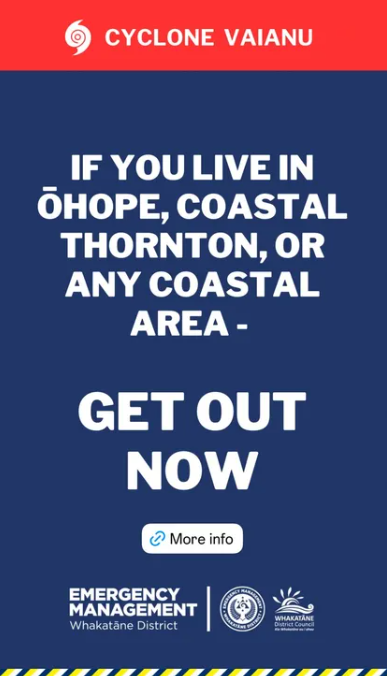
- If you received an evacuation alert, follow it. A mobile alert for Whakatāne told residents to leave Ōhope, Coastal Thornton and other unsafe coastal locations before noon; those who did not evacuate have been told to shelter in place.
- Stay indoors and away from trees on the Coromandel Peninsula; avoid the coast and do not enter floodwater.
- Delay all unnecessary travel in Auckland today; expect ferry cancellations and possible extended closures of the Auckland Harbour Bridge.
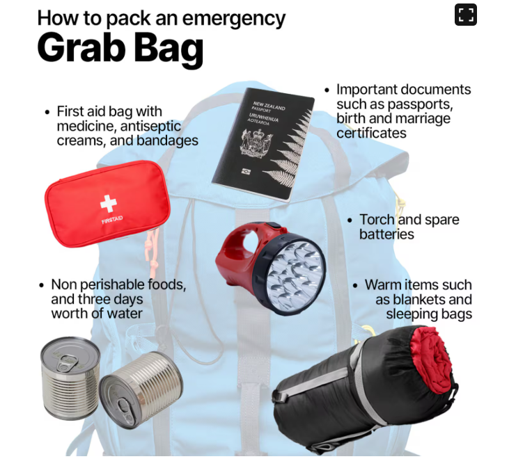
- Prepare an emergency grab bag with essentials: water, non‑perishable food, torch, batteries, phone charger, first‑aid kit, warm clothing, important documents and any required medication.
Latest notable updates
- Thames‑Coromandel: Civil Defence response winding down; centres on standby.
- Bay of Plenty: Cyclone centre has passed Rotorua and is tracking south‑southeast; several hours of rain remain and winds may shift direction, bringing down weakened branches and debris.
- Coromandel: boat ramp collapse reported; localised infrastructure damage being assessed.
By Sarah McMillan-Updated: Sunday, 12 April 2026 — 09:35 NZST
Cyclone Vaianu is now impacting New Zealand’s North Island, moving south across the region and bringing damaging winds, heavy rain, coastal inundation and large swells. Authorities report widespread power outages and multiple states of emergency as communities brace for the worst of the storm.
What’s happening now
- Storm position and movement: Vaianu is tracking south over the North Island today, with the main band of severe weather affecting coastal and eastern districts.
- Power and infrastructure: Significant power outages have been reported in Northland, Tauranga, Coromandel and Auckland.
- States of emergency: Declared for Northland, Whakatāne, Waikato, Ōpōtiki, Hawke’s Bay, Tauranga and Western Bay of Plenty.
- Evacuations: Residents in coastal Hastings and Ōhope have been told to evacuate now. Local authorities have opened emergency shelters for those who need them.
- Warnings: The entire North Island is under severe weather watches or warnings. Red strong wind warnings are in place for Great Barrier Island, Coromandel Peninsula, Bay of Plenty and Rotorua, where gusts of up to 130 km/h are expected and some areas are warned of gusts up to 150 km/h.
Local council message and urgent orders
Whakatāne District Council has issued an urgent evacuation notice for Ōhope, coastal Thornton and other coastal communities within the district, saying the cyclone’s track has pivoted and those areas are “directly in the firing line.” The council warned winds could gust up to 150 km/h and instructed residents to leave for locations further inland before 12 noon.
Whakatāne War Memorial Hall and Rangitihi Marae are open as emergency shelters for anyone with nowhere else to go.
What authorities are telling residents
- Prepare to evacuate: Have a grab bag ready with essentials and be prepared to leave immediately if ordered.
- Avoid travel: Do not travel unless absolutely necessary. Roads may be blocked by fallen trees, debris or flooding.
- Secure property: Clear gutters, tie down loose outdoor items and move vehicles to higher ground if possible.
- Expect outages: Plan for extended power and communications outages; keep phones charged and have torches and batteries ready.
- Follow official channels: Heed mobile emergency alerts and local council instructions.
Grab bag checklist
Essentials to have ready: photo ID; mobile phone and charger; essential medications; water and non-perishable food for 72 hours; warm clothing and blankets; torch and spare batteries; basic first-aid kit; cash; important documents in a waterproof bag; pet supplies.
Coastal hazards
- Large swells and coastal inundation: Swells up to 8 metres are expected along exposed coasts. Move away from beaches, estuaries and low-lying coastal areas now.
- Flood risk: Heavy rain may cause river and surface flooding. If you are in a flood-prone area, move to higher ground.
This is an active and rapidly changing situation. Follow instructions from local emergency services and your council, monitor official alerts, and prioritise safety for you and your household.
By Sarah McMillan- updated Saturday 5pm
Cyclone Vaianu is now bearing down on New Zealand, with its arrival expected late Saturday night and authorities warning of a “major wind event” capable of causing life‑threatening conditions across the North Island.
Six regions — Northland, Whakatāne, Waikato, Ōpōtiki, Hawke’s Bay and Western Bay of Plenty — have declared local states of emergency as the cyclone’s outer bands begin to lash the country. Evacuations are already underway in several districts, with officials urging residents to move early while daylight remains.
Multiple mobile emergency alerts were issued on Saturday, advising people to prepare for power outages, avoid unnecessary travel, secure loose outdoor items, and keep grab bags ready in case rapid evacuation is required.
Red Wind Warnings Now in Place for Four Regions
MetService has upgraded strong wind warnings to red — its highest alert level — for:
- Great Barrier Island
- Coromandel Peninsula
- Bay of Plenty
- Rotorua
At 1pm, Vaianu was positioned about 500km north of New Zealand, but its impacts were already being felt. Gusts above 110kph were recorded at Mokohinau Island and Great Mercury Island, with forecasters warning that gusts could reach 130kph in the newly upgraded regions.
MetService meteorologist John Law said winds of this strength could cause “a threat to life from flying items and falling trees” and lead to widespread damage, including to roofs and powerlines.
Heavy rain warnings are also in force for most of the North Island and for eastern Marlborough, particularly between Blenheim and Kaikōura and around the Richmond Range. Swells of up to eight metres are expected on north and east‑facing coasts, especially around high tide.
Government Says Emergency System Fully Activated
Civil Defence Minister Mark Mitchell said New Zealand was “as ready as it can be” for the cyclone’s arrival.
“We’ve seen the devastation in Fiji. We know it’s coming, and the whole emergency management system is activated,” he said. “Evacuations are happening early because these events become exponentially more dangerous at night. It’s safer for communities and for first responders to move now.”
Mitchell said the country should expect 140km/h gusts, significant rainfall, and dangerous coastal conditions as Vaianu approaches.
Major Events Disrupted
The worsening forecast has forced the cancellation of Sunday’s ITM Taupō Super 440, with organisers citing safety concerns for teams, spectators and emergency crews.
What to Expect Overnight
- Saturday evening: Winds strengthen across the North Island
- Late Saturday night: Vaianu makes its closest approach; peak winds and rain
- Overnight–Sunday: Power outages, road closures and coastal inundation likely
- Sunday: Hazardous seas continue; early damage assessments begin
Residents in affected regions are urged to stay informed, follow official instructions, and be prepared to leave quickly if conditions deteriorate.