



By Colin Ambler/cvnznews.com.
5pm Update: The top half of the North Island is now under a severe thunderstorm watch, with MetService warning that a fast‑moving band of heavy rain and unstable air will sweep across northern regions this afternoon, bringing the risk of flash flooding, damaging winds and isolated tornadoes.
Northland, Auckland, Great Barrier Island and Waikato are on alert from 3pm to 8pm, the window in which forecasters expect the most intense activity. The storms are forecast to deliver 10–25mm of rain per hour, wind gusts reaching 100km/h, and the possibility of small, short‑lived tornadoes forming along the leading edge of the system.
The warning comes after a highly active morning in the atmosphere, with 6,200 lightning strikes recorded over central New Zealand as the trough powering today’s weather pushed north.
NZTA is urging Aucklanders to prepare for significant travel disruption, particularly across the Auckland Harbour Bridge, where winds are expected to strengthen sharply this afternoon. Gusts of 75–85km/h are possible over the bridge, potentially coinciding with thunderstorm activity.
Electronic motorway signs will be used to signal lane closures, speed reductions or full restrictions if conditions deteriorate. Drivers of high‑sided vehicles, motorcyclists and those towing trailers are being advised to take extra care or delay travel if possible.
MetService says the atmosphere remains “highly unstable” and that conditions could change rapidly through the late afternoon and early evening. Localised downpours may overwhelm drains and cause sudden surface flooding, particularly in low‑lying or urban areas.
Forecasters will continue updating watches and warnings as the system moves eastward, with further advisories expected into the evening.
Original Story Published 9am.
New Zealand is staring down yet another turbulent weekend, with MetService warning of a “very active” weather system sweeping across the country and bringing the risk of thunderstorms, damaging winds and even small tornadoes.
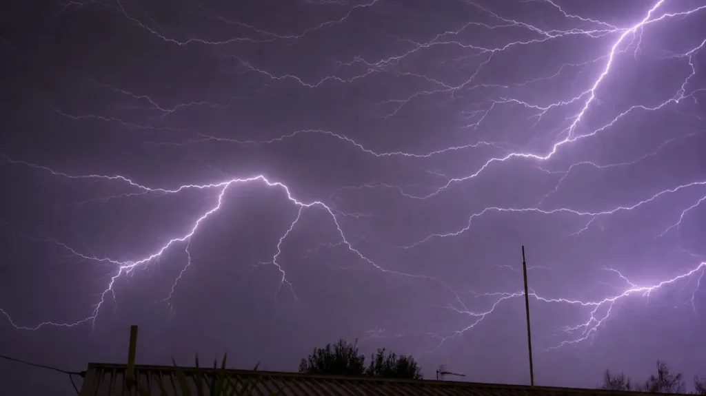
A dramatic lightning storm lit up the skies over the top of the South Island late on Thursday before tracking north toward Wellington, signalling the arrival of a volatile trough feeding moisture and instability into both islands.
By Friday morning, orange heavy‑rain warnings were in force for Taranaki north of Eltham and the Bay of Plenty east of Whakatāne, with forecasters expecting intense downpours as the day progresses. Thunderstorms could deliver wind gusts up to 100kph across parts of the North Island.
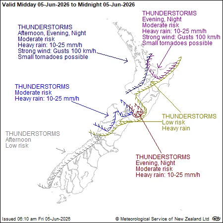
The risk of localised tornadoes—while small—covers a wide swathe of the country: Taranaki, Waitomo, Waikato, Auckland, Northland, the Coromandel Peninsula and the Bay of Plenty.
MetService meteorologist John Law told RNZ that tornadoes were “not out of the question”, though any that formed would be “very small, localised affairs”.
“Pinpointing where they’ll be will be one to watch out for,” he said, noting the greatest risk sits along western coastal areas. “What we’re really looking at is the risk of stronger, gusty winds… whether they’re spinning around or in a straight line, they could be causing some issues.”
A broad set of heavy‑rain watches also covers Rotorua, Taupō, Waitomo, Taumarunui, Tongariro National Park, Horowhenua, Kāpiti Coast, Wellington and the Tararua Range, with forecasters expecting updates and possible upgrades around 10am.
MetService meteorologist Stephen Glassey said the most active weather today would hit Taranaki, Kāpiti and Wellington, where the main rain band is already feeding into western and southern districts.
Northland, Auckland and Waikato face their highest thunderstorm risk this afternoon and evening. While bursts of heavy rain are expected, Glassey said warnings haven’t been issued because the events are “too brief”.
With saturated ground in many regions and winds expected to strengthen through the afternoon, authorities are urging New Zealanders to stay alert, secure loose items and keep a close eye on rapidly changing forecasts.