

Sarah McMillan/cvnznews.com
If you’re heading over the passes after the All Blacks test, taking the kids away for the school holidays, or simply trying to get to work on Monday, here’s the question you need to ask yourself: what happens if the biggest snowfall of the winter hits while you’re on the road?
Because that’s exactly what forecasters say is lining up for Canterbury and the alpine highways early next week — a sharp flip from the calm, frosty days we’ve just enjoyed.
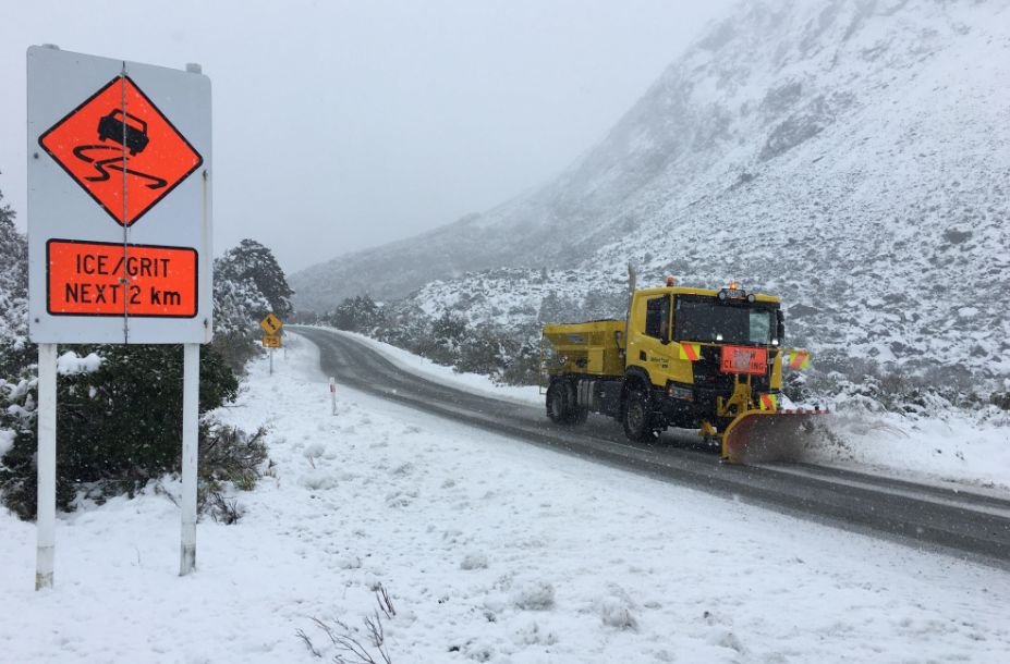
New Zealand Transport Agency Waka Kotahi (NZTA) says snow is expected to arrive from Sunday, with Monday and Tuesday shaping up as the danger zone. Porters Pass and Lewis Pass could see up to 20cm, while the Mackenzie Basin — from Burkes Pass through to Lake Tekapo — faces 10cm or more on Tuesday.
That’s enough to close highways, delay travel, and turn a routine drive into a long, cold wait.
And it’s not just snow. Before the white stuff arrives, MetService has heavy rain and strong wind warnings for much of the South Island’s western and alpine regions. Rivers may rise quickly, slips are possible, and driving conditions could deteriorate fast. Severe northwest gales in the Canterbury high country may gust up to 130km/h.
NZTA is urging travellers to prepare properly:
- Pack warm clothes, food, water
- Charge devices and ensure fuel or EV range
- Expect delays, detours, or full closures
- Slow down in heavy rain and avoid sudden braking
- Never drive through floodwaters
- Take extra care if towing or riding motorcycles in strong winds
With school holidays underway and major events drawing crowds, the timing couldn’t be trickier. The advice is simple: plan ahead, check MetService warnings, and monitor NZTA’s Journey Planner before you hit the road.
Next week’s snowfall could be the biggest of the season — and it’s coming right when the country is on the move.